Written by Eva Smeele, a passionate hiker and storyteller.
Hiking the Balkans, hiking a long-distance trail through the Balkans, hiking a brand new long-distance route through the highest mountains of the Western Balkans.
Does that sound good to you?
If that sounds good to you, the Via Dinarica is what you’re looking for.
The Via Dinarica is a physical challenge, a serious adventure, but most of all, hiking the Via Dinarica is a journey of a lifetime.
With its three main trails, Via Dinarica connects the seven countries (Slovenia, Croatia, Bosnia & Herzegovina, Montenegro, Serbia, Kosovo, and Albania) of the Dinaric Alps, Europe’s largest karst field.
- The White Trail traverses through the highest part of the Dinarides. It’s a mountain trek with a length of nearly 1300 kilometers and a total elevation of 52,000 meters.
- The Green Trail meanders through the lower valleys north of the White Trail and includes Serbia and Kosovo.
- While the Blue Trail follows the Adriatic coastline, which is mainly Croatia.
How do I know all of this? I hiked it, that’s how.
Skip Ahead To My Advice Here!
My Via Dinarica Story
I found a few stories of people who hiked sections of the route on the internet, a route they called Via Dinarica, based on old shepherd paths through the Dinaric Alps. When I first found out about the Via Dinarica, there actually was no trail at all. I wanted to explore those mountains, this wild piece of nature, and experience the unique culture of the Western Balkans.
I put the available information about water sources, mountain huts, facilities in towns, available hiking maps, and border-crossing procedures in an Excel spreadsheet. I didn’t expect marked or well-maintained hiking trails, and I only had a rough idea of the route. I tried to bring an idea by creating a pushpin trail on a big map on my living room wall.
The Via Dinarica Is More Than Just A Trail
In March 2016, Terra Dinarica launched the Via Dinarica White Trail, a GPS track with 45 stages. By using the online Outdooractive technology, the crucial issue of non-existing hiking maps was efficiently solved.
All the essential information about the route is gathered on one platform. It’s downloadable; there is an offline app, and hikers can share their trail notes in the Via Dinarica community.
Suddenly my pushpin trail turned into something so much bigger. Inspired by Via Dinarica’s mission to create a platform for sustainable eco-tourism that supports the local economy, preserves the unique culture, and protects nature, I decided to share my experiences with the virtual world. I started a blog and named it “EVAdinarica Project.”
What Is It Like Hiking The Via Dinarica As A Female Solo Hiker?
Being a woman alone in the mountains got me some attention.
Quite a lot.
It’s something odd, something new, and yes, something crazy, according to most people I met. “Don’t you have a car?” some asked, “but why alone?!” everybody asked. “Where is your husband? How does your mother feel?” the old ladies wondered. And “aren’t you scared?” is what the guys wanted to know.
Ironically, many people seem to fear other people more than bears, thunderstorms, or landmines. There might be a reason for that, but I believe it starts with your own attitude. I can only say that I never felt unsafe hiking the Via Dinarica. And I think we should overcome our fear of the unknown instead of labeling it as dangerous.
Despite all those questions about hiking the Via Dinarica solo, people made me feel welcome. They would probably never fully understand what I was doing. I could not explain, but I could sit down and spend my time with them. Drinking coffee, sharing food, and letting them be part of my journey. It’s the unexpected encounters that were the most meaningful for me.
Encounters that would have been different if I weren’t alone. Meetings that gave me a little look behind the scenes, a closer look into the life of total strangers. Encounters that made my fascination and my love for the region grow even more.
A New Beginning
The Via Dinarica White Trail officially starts in Slovenia, crosses Croatia, Bosnia & Herzegovina, and Montenegro, and finishes in Albania.
As well as hiking alone, I hiked it the other way around and started in the highest part of the Dinaric Alps, Prokletije National Park.
My main rule was “to take enough time.” Time to discover and explore, to experience and feel the Western Balkans and its unspoiled wilderness. That’s how hiking the Via Dinarica solo became so much more than just a trail.
When the temperature dropped significantly in October, I reached my goal – the Via Dinarica finish line. I completed the trail.
I survived hiking the Via Dinarica solo, which included detours, wrong turns, and extra day trips; I hiked over 1500 kilometers of the Via Dinarica.
After four months on the Via Dinarica, it felt surreal that it was done. Over. So, I looked at it differently. This doesn’t have to be the finish. It could be a new beginning… So, this year I’m hiking from Amsterdam back to the Balkans. In Slovenia, I’ll pick up the Via Dinarica Green Trail and follow it all the way to Sarajevo. I’d love to write about that as well, but let me tell you about the Via Dinarica White Trail first.
Brands We Use And Trust
Via Dinarica White Trail Highlights
Keep in mind that I describe the route from East to West, from Albania to Slovenia, while officially, the Via Dinarica goes from West to East.
Per country, I will share one highlight. Of course, there were many more; in fact, I could write a book about the highlights of my solo expedition on the Via Dinarica trail.
For me, highlights are places where I had a fantastic time, where I met inspiring people, where the view was absolutely breathtaking, or where I had such an absurd experience that I can’t stop smiling when I think of that moment.
Via Dinarica: Prenj, Bosnia & Herzegovina
Let’s start with Prenj, where I experienced all of this at the same time. Although Čvrsnica is just as beautiful, Prenj is definitely one of the highest highlights in Bosnia & Herzegovina for me. I’ll tell you why.
From whichever side you hike your way up, it’s a long, steep route through a dense, dark forest. The contrast with the higher part of Prenj is extraordinary. An impressive, wide, Alpine landscape with prominent peaks, scree slopes, and rock formations is what you find once you’re up. It’s rough, high, dry, and desolate. A different world. A different planet. Planet Prenj, a friend of mine, calls it.
That particular friend provided me with maps and an alternative route from Boračko jezero to mountain hut Jezerce. He told me where to find water and where to stay.
He didn’t tell me that he was planning to pay a visit to Prenj as well. While I was taking a break on Zelena Glava, enjoying the undescribable beautiful view, I suddenly heard someone shouting, “Is there a girl from Amsterdam here?” It was absurd to meet a friend on Prenjs’ highest peak. Absurd, fantastic, and memorable for sure.
Via Dinarica: Sinjajevina, Montenegro

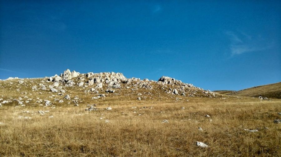
This Montenegrin stage is a pretty dry piece of nature, a typical karst landscape. Walking on this mountain made a huge impression on me partly because I was warned and discouraged to go there.
Hiking this stage on my own and discovering Montenegro’s beauty left me with an unbelievable strong feeling and beautiful, meaningful memories.
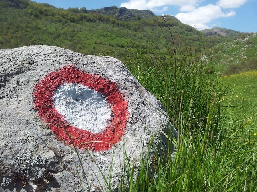
There are no hiking maps available, and the waymarks tend to disappear in the grass; a GPS is definitely a must-have for this stretch of the Via Dinarica.
For at least three days, you’re up in the mountains. Green, grassy mountains covered with white stones. No impressive peaks at the horizon to intimidate you, but clouds. The incredible, unpredictable weather is what kept me busy all day. There are not many places to hide, it’s wide, open, and you’re at a high altitude. You’re vulnerable.
Nature showed me who’s the boss. It allowed me to be there. It’s nature who decides. That’s what I felt when I was there. I felt so small but extremely grateful.
Via Dinarica: Prokletije, Albania
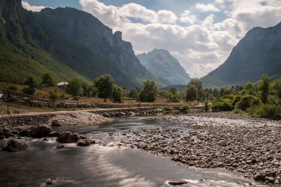
Surrounded by the pointy peaks of the profound Prokletije mountains, I felt slightly intimidated on my Via Dinarica journey. I felt unfit, was quickly out of breath, had a cumbersome backpack, and was not used to the altitude yet.
The trail was demanding, and I started to doubt. What am I doing? I wondered. Take as much time as you need is what I had to tell myself. Over and over again. And you know what, it worked. As soon as I let go of day stages, time schedules, and most importantly, my own expectations, I could enjoy. I enjoyed the intensity of the physical effort and the beauty of the fantastic Albanian Alps.
I enjoyed being at Prokletije and being present.
Via Dinarica: Velebit, Croatia
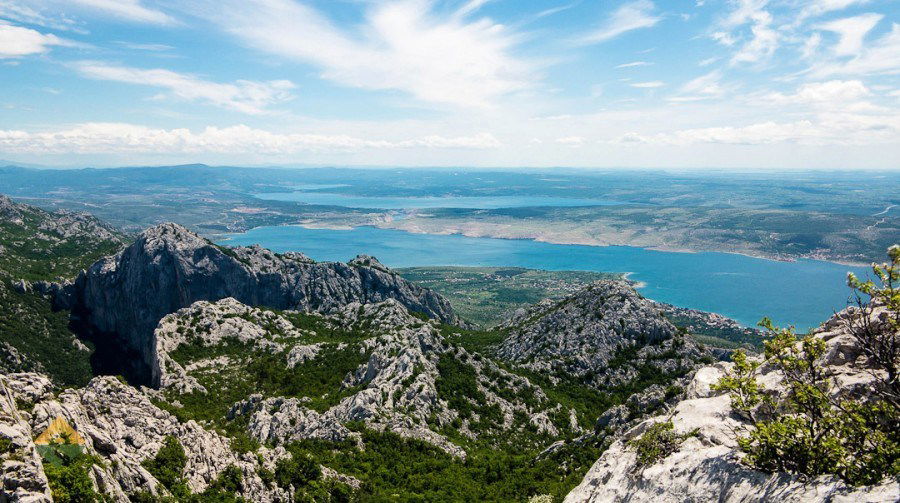
The Velebitski Planinarski Put is a 100 kilometer long, well-maintained hiking trail that traverses the largest mountain range of Croatia, Velebit. It connects Northern Velebit with Paklenica National Park and is not only a classic route, but it’s also part of the Via Dinarica as well.
The well-known Premužićeva Staza is a popular section of the Velebit trail, a red carpet with superb vistas on the Adriatic sea. At the same time, you most likely experience the typical Croatian mountaineers’ traditions. Eating, drinking, and singing.
The Velebit is full of mountain huts, which means you don’t have to bring your tent. It also means meeting new people, learning to drink rakija, and sharing a “dorm” with many other smelly hikers. Perhaps it doesn’t sound like a highlight to you, but believe me, after being alone for several weeks, I really appreciated the company of those joyful strangers. As long as you surrender and party along, it’s a great way to experience the Balkans.
Via Dinarica: Nanos, Slovenia
At the end of my trip, the days were getting shorter real fast. Winter was on its way, and I felt the tiredness kicking in. Nonetheless, I decided to prolong the official route by adding one more mountain. Nanos. When you’re at Predjama, a beautiful castle built in a rock wall, it’s hard to ignore the mountain that is dominating the area.
One more time, I ascended, and one more time, I experienced the ultimate pleasure of looking back to where I came from. It’s a special feeling to stand on the top of a mountain and realize that you hiked every step. Every single step.
Nanos is not just another mountain. Nanos is a vast plateau that allows you to hike another day or two. So I did. Ending on a plateau felt kind of symbolic. Ending on a plateau that forms the beginning of an enormous mountain range, the Dinaric Alps felt in a strange way very satisfying. Not like a finish; I didn’t feel done, satisfied, yes, but done, no.
To be continued…
Practical Via Dinarica White Trail Information
General Tips For Hiking The Via Dinarica
I spend a fair amount of time on the preparation for my hikes. Although there is a GPS track of the route that includes waypoints of water sources, accommodation, and other facilities, I strongly recommend reading about the trail, the region, experiences of others and have a good look at the map before you go.
Ensure you know how to use a GPS, freshen up your navigating skills and check the conditions and comments on www.viadinarica.com. This is a community for Via Dinarica hikers, incorporated on the interactive online Outdooractive platform.
Also, you’ll need a good hiking backpack, especially if you want to bring your camera (and you should!).
Resupply Stops Along The Via Dinarica
It’s not necessary to send yourself supply boxes, but it does make things easier.
In Tjentište (Bosnia and Herzegovina), for example, is a little convenience store that sells the basics, but for real shopping, you need to go to Foča. Whenever I’m having a day off, I prefer to do absolutely nothing—waiting for buses, strolling through busy cities, or doing any other logistics are not my favorite. So, I happily unpacked my box in Tjentište and spent the rest of the day at the swimming pool. An excellent way to go, right?
In general, you’ll find a (small) convenience store at least once a week. Jablanica is definitely the main town to resupply in Bosnia and Herzegovina and Kalinovik, Tjentište, and at Buško jezero, there are opportunities to buy food and snacks.
In Montenegro, you don’t have to leave the trail for shopping; in Žabljak, Mojkovac, and even in Gusinje (close to the Albanian border), several supermarkets provide everything you possibly need.
Croatia, on the other hand, needs some planning. The stretches are long, and facilities minimal. Knin is the biggest city on the trail, but other than that; you’re forced to either take a detour, take a bus, send yourself some packages, or carry a whole lot of food.
Sinj, Starigrad Paklenica, Senj, and Delnice (more or less) offer a great variety of stores, just as a good opportunity to take a break for a day or two.
In Slovenia, I went to Ilirska Bistrica (which is far off the (official) trail), Podcerkev, Cerknica, and Postojna to get myself some fresh goods.
Via Dinarica Trail Accommodation
Depending on your budget, you can spend the nights in Eko Katuns, mountain huts, guesthouses, B&B’s, hotels, or you can stay with locals in their rural households.
If you choose not to bring any camping gear, which is possible if you have excellent planning ánd long-distance hiking skills, I recommend arranging your accommodation ahead.
For the Via Dinarica mountain huts in Bosnia and Herzegovina, for example, you need to find someone with the key. If you don’t, there is a big chance that it’s closed. Other places are simply “not working” if there is no reservation.
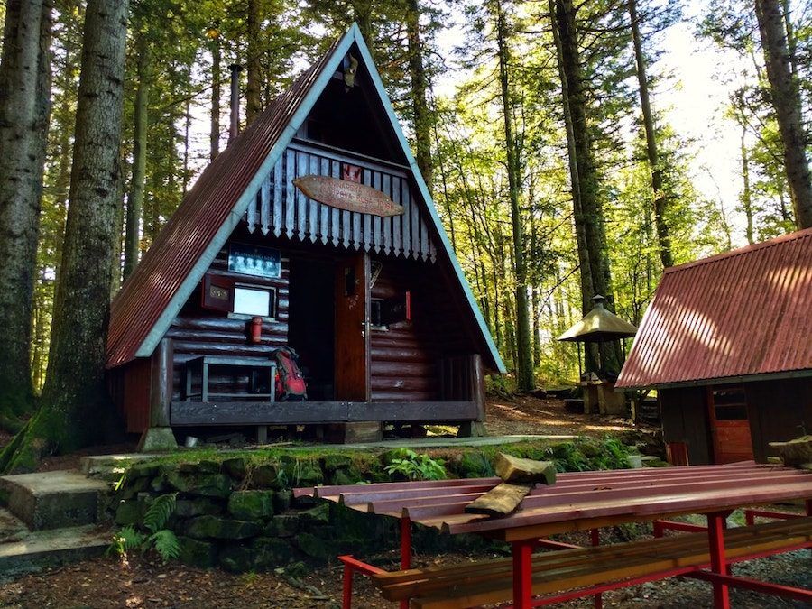
The basic mountain huts “planinarsko sklonište” in Croatia are accessible for everyone and usually free of charge.
The local mountaineering associations voluntarily take care of these huts. Therefore the state differs from place to place. There are also staffed huts; their quality and prices vary as well. In short, you never know what you’ll get, but hey, that’s life.
Water Along The Via Dinarica
The GPS track and waypoints aren’t always accurate. Trails can be replaced, overgrown, or simply not matching the route on your GPS.
It happens that water sources dry out, disappear, or are impossible to find. Wells and cisterns can get infected, and during an arid summer, the collected rainwater at the huts might not be enough to provide hikers with water.
You must know what to expect and how to anticipate. So yes, bring a waterpurification filter, drops or tablets. Buy hiking maps if you can find them, and check if the map on your GPS shows water sources.
Conditions Of The Via Dinarica Trail
The Via Dinarica is still in development.
Only the Bosnian part of the White Trail is officially open. This means that in Bosnia and Herzegovina, the trails are signposted and marked with Via Dinarica signs.
Nevertheless, there is still a lot of work to do. In Slovenia, Croatia, Montenegro, and Albania, the trail mostly follows old, existing routes like the Crna Gora Transverzala (Montenegro), the E6 (Slovenia), and the Velebitski planinarski put (Croatia). Again, check the conditions and comments for each stage in the Via Dinarica community.
Border Crossing
Between Albania and Montenegro, you have to apply for a border crossing permit.
Whichever route through Prokletije you choose, you’ll have to cross the border to Montenegro without finding any checkpoint. Unfortunately, it is a pretty bureaucratic procedure. You have to give the exact date at least 15 days ahead, the application forms and procedures change all the time, and they are hard to find in English.
I suggest asking a local touring agency for help. I took the risk and crossed the border “illegally.” What is the worst thing that can happen, I wondered…
As far as I know, there’s no standard procedure to cross the border between Montenegro and Bosnia and Herzegovina. Perhaps that guided groups have to get permission, but I again entered without getting a stamp.
When I reached the border between Bosnia and Herzegovina and Croatia, I officially never left Albania. Nobody seemed to notice. So, my experience is that you don’t have to stress about it too much. On the other hand, I don’t know what will happen at the airport, where the passport controls are a bit stricter.
The Via Dinarica Trail makes a detour via the border checkpoints instead of following the mountains’ most natural route, This is due to Croatia being apart of the European Union but only recently became a Schengen Country. From 1 January 2023, Croatia is now a part of the Schengen Zone and land and sea port borders were abolished and airport borders will be abolished from 26 March 2023.
I wanted to hike from Buško jezero (Bosnia and Herzegovina) to Kamešnica, Troglav, and follow the mountains all the way to Dinara, Croatia’s highest peak. Just like I wanted to track the old hiking route from Snežnik (Croatia) to Snežnik (Slovenia), but I was strongly suggested not to do that because it’s strictly forbidden. I listened, but I have to confess that those two tours are still on my mind. I hope to find a way to make them any time soon.
When Is The Best Time To Hike The Via Dinarica?
It is all about the weather.
The best hiking season is from May until November. There might still be some snow in the higher mountains early in the season, especially when you start in Prokletije. But also, when you’re late, you can end up in the snow.
The summer months are hot, many of the trails are exposed, which means it’s windy, and there’s a lot of sun. The landscape is very, very dry, that’s characteristic of the karst mountains. There is not much surface water, down jacket and when it rains, the water immediately disappears. Velebit is known for the mighty wind called Bura. In Velebit and plenty of other mountains, the weather is unpredictable and can change within minutes.
So, be prepared. Bring sunscreen, good travel shoes, a lightweight rain jacket, and of course, a packable down jacket.
Are you now inspired to hike the Via Dinarica? Will you hike it solo? Will you go in the opposite direction?
- All About Traveling In The Balkans
- Guide To Backpacking In The Balkans
- Best Beaches In The Balkans
- Top Places To Go Hiking In The Balkans
- One Month Itinerary For Traveling Through The Balkans
- Ultimate 5-Day Balkans Travel Itinerary
- Two Week Road Trip Itinerary Through The Balkans
- Balkan Cruises – Where You Can Cruise To In The Balkans
- Southwestern Balkans Road Trip


Hello!! I don’t know if you will see this message but did you find other walkers during he hike or you whre completely alone all the time? I am a but scared of that so I am thinking maybe on starting in Bosnia. Thanks!
Violeta
Hi Violeta! Thinking in doing it this August, starting in Bosnia as well. It could be nice to meet at some point if our dates overlap : ))
Hi Violeta, I obviously didn’t see your message – I’m sorry! And, did hike? And did you meet other people? I met about 5 or 6 other Via Dinarica hikers, since I was walking in opposite way they sooner or later had to cross my path. Not sure what it’s like now, but I think it is still far from crowded, right? Grtz.eva
Hi Smeele,
two questions pop up in my mind having red your interesting article. Maybe you can share your experiences with us.
I am planing to start my hike on the Via Dinarica in Montenegro (plav) and I want to hike to Bosnia (mostar).
1/
If I cross the green border without official permission from Montenegro to Bosnia, do I get trouble when I leave Bosnia by plain to Europe. The whole permit issue seems to me quite confusing.
2/ Where did you buy your camping gas, if so? Is there any possibility to get gas on in podgorica or plav? I think this issue could be of interest of other readers as well who prefer to cook on the trail.
Thank you,
Jonas
hello
I am looking for going to Croatie and follow the blue way.
Could you tell me if there are markings on the way ?
Did you find lot of water sources ?
And then is there a topo guide that I can buy ? Like for the GR20 in Corsica.
Thank you in advance for your answer.
Chistelle
Hi Chistelle,
To be honest, the Blue Trail isn’t a trail like the GR20. It’s more or less a collection of other coastal trails. Therefore it is marked when the route takes hiking trail, but there are also road sections. Those aren’t marked. If you’re looking for a long distance trail with huts and other facilities there are only a few sections on the Blue Trail I can recommend. Check out the Biokovo Planinarske Staze and also Omiška Dinara, Mosor and Kozjak are great for multiple day mountain traverse kind of hike. You can do it in one stretch.
It is tricky with water though, NO you most definitely won’t find a lot of water. The opposite is true. And it gets pretty hot in summer. Also it might be good to bring a water filter, because if you find water it’s most likely not running. I recommend to have a good look on Outdooractive (tours) and other (online) maps, do a proper research so you know where the water sources and cisterns are. Some huts collect rainwater or have a cistern, but there not all accessible.
Besides the GPX track & descriptions on the viadinarica.hr website, there isn’t much info. No guide book or topo. I hiked the Via Dinarica Blue Trail this winter and will upload trailnotes etc on my website (EVAdinarica Project), but that’s gonna take some time. Another option is to have a look at the Via Adriatica trail. I’d suggest to combine both routes.
Hope this helps. Good luck and have fun!
Grtz.eva
Hello,
I am looking into hiking a section of the Via Dinarica for 2/3 weeks in October to raise money for charity! Could you recommend a route for that amount of time? I will not be well equipped with camping/hiking gear so sections that are well supplied/catered for would be better for me :)
Cheers,
Sally
Hey! I am thinking of walking the White Trail this year. Any chance we can get in touch to talk about details? Thanks!
Hi Smeele
Long distance hiker from NZ here. Im looking at doing the white trail in 2024.
I have loads of questions and was wondering if you could gove some guidance of I email you? If so, send me an email to me and I have a list.
Thanks